Forgotten Trails
Forgotten Trails Association
Creates, maintains and promotes safe and ecologically sustainable trails of natural or historical significance in the South River area. The four-season, backcountry trails are managed by volunteers for the purpose of non-motorized recreational trail activities. Contact Discovery Routes to get involved with revitalizing the Forgotten Trails.
There are many opportunities to enjoy the beautiful outdoors in the South River area. The Forgotten Trails explore some of the scenic and historic hiking trails available. Click here to see a PDF map.
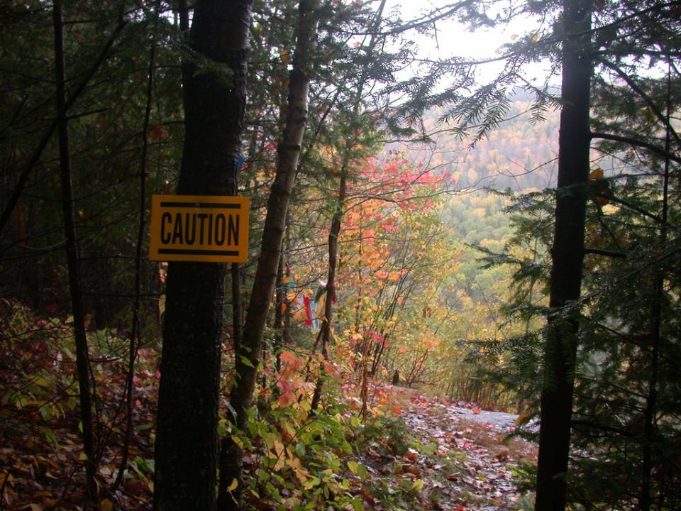
Read about bear safety here.
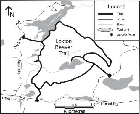
A trail in the Forgotten Trails Association network.
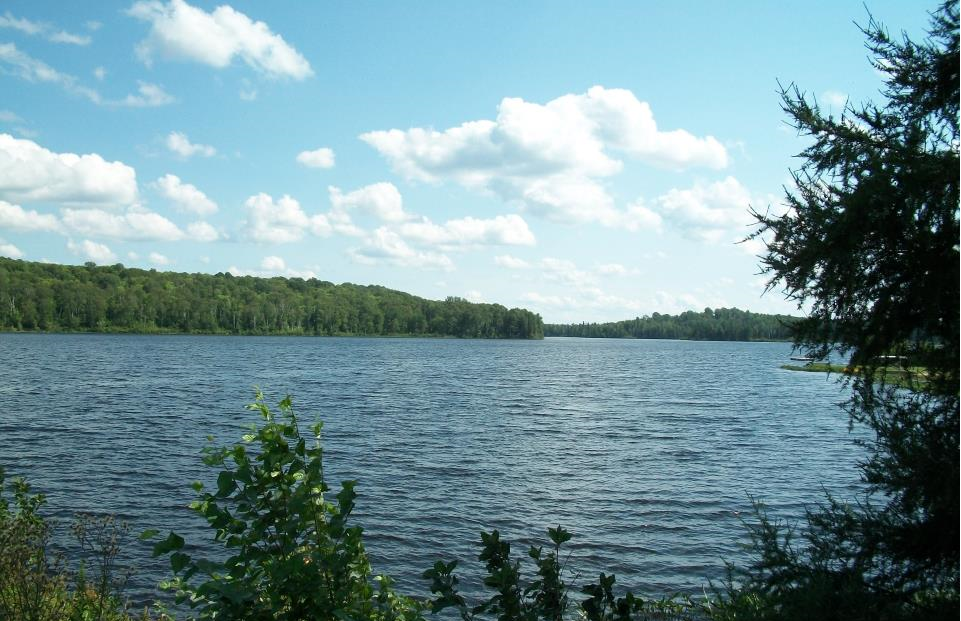
Originally built and maintained for winter use as a ski trail, the trail is now opened for the summer as a hiking trail. The majority of this trail is moderately difficult, there are areas that features challenging climbs and descents. The trail meanders through a mixed coniferous and deciduous forest. This route will take hikers past Loxton Lake and Beaver Lake, both of which are visible from the trail, and through various terrain including bogs, fens, and marshlands. At one point, the path emerges at the Loxton Dam, which is a soothing spot to take a break, and dangle hot, tired feet in cool water before continuing on your hike.
Trailhead UTM 637811 mE x 5087167 mN
Ownership Crown Land
Management Forgotten Trails Association
Length 8.5 km loop
Activities Cross-Country Skiing, Hiking, Snowshoeing
Difficulty Moderate to Hard
Level of Development Minimally Developed
Surface Compacted Soil, Mixed Gravel
DIRECTIONS
From the Village of South River turn east at Ottawa St. and continue onto Chemical Road for approximately 17.9 km (11.1 mi). The trail is located on the left side of the road, though signage may not be visible.
Find more information on the Discovery Routes Website: Loxton Beaver Trail
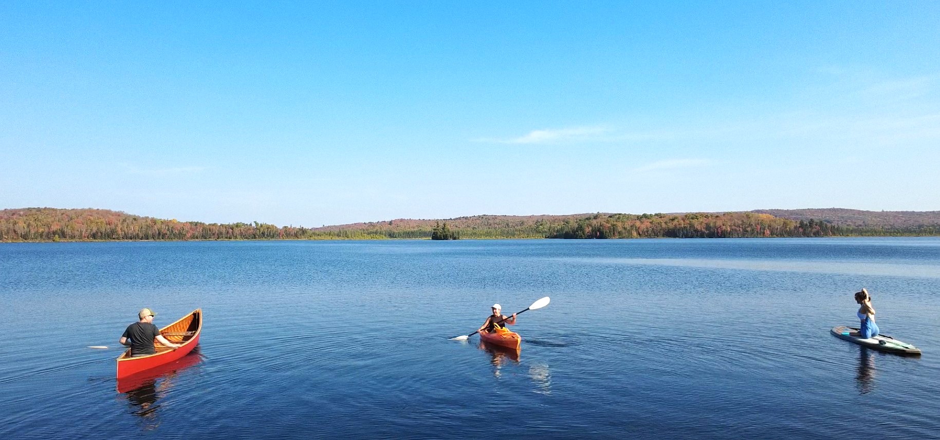
The South River Water Trail is 14.5km long and runs from Himsworth Beach at the Hydro Pond and ends at the rapids known as the Hog’s Trough just past the bridge on Highway 522. There are two short portages around hydro dams of about 500 meters. There is also an alternate access point at the Hummel Bridge on McCarthy Road.
Length 14.5km
DIRECTIONS
From the HWY 11/17 junction near Seymour Street, head South west on HWY 11 for about 27km. Take exit 316 toward Clark Street/Powassan, then turn left onto ON-534. Turn left onto Maple Hill Road, then a right onto Purdon Line.
Find More information on the Discovery Routes Website - South River Water Trail
The One-a-Day Trail is a comfortable, short walking trail, which can also accommodate cross-country skiing and snowshoeing in the wintertime. The trail terminates at the picturesque One-a-Day Lake, a perfect spot to dip your feet in and relax.
Trailhead UTM 640591 mE x 5085879 mN
Ownership Crown Land
Management Forgotten Trails Association
Length 1.2 km
Activities Hiking, Snowshoeing
Difficulty Easy
Surface Compacted Soil, Mixed Gravel
DIRECTIONS
From the HWY 11/17 junction near Seymour Street, head southeast on HWY 11 for about 57 km (35.4 mi) until you reach the Village of South River. Turn left at Ottawa Street. Continue onto Chemical Road. Turn right after approximately 20 km (12.4 mi) just before the Park entrance. The trail is located about 1.3 km (0.81 mi) up the road, across from the lake on the right hand side, though signage may not be visible.
For more information please visit the Discovery Route Website - One a Dat Trail
The Laurier Tower Trail is a lookout trail in Ontario, near South River. Originally, the Ministry of Natural Resources built the trail to access the old Fire Tower – today it’s lightly managed by Forgotten Trails, a volunteer trails group based in South River.
Be prepared for a steep climb through a majestic hardwood forest on this 2 km out-and-back hiking trail. But don’t worry, the challenge is well worth the breathtaking scenic view over the Almaguin Highlands.
Make sure to keep an eye out for the original foundation blocks of the old fire tower – they are still there for you to discover!
Explore South River has installed interpretive signs throughout the area to tell the stories of the area’s past.
Trailhead UTM 637281 mE x 5085878 mN
Ownership Crown Land
Management Forgotten Trails Association
Length 2.1 km
Activities Hiking
Amenities Backcountry
Difficulty Moderate
Level of Development Minimally Developed
Surface Natural
Seasons Summer
DIRECTIONS
From the HWY 11/17 junction near Seymour Street, head southeast on HWY 11 for about 57 km (35.4 mi) until you reach the Village of South River. Turn left at Ottawa Street and continue onto Chemical Road. Approximately 16.5 km (10.3 mi) up the road, turn right onto Tower Road. The trail is located on the left hand side of the road roughly 1.4 km (0.87 mi) later though signage may not be visible.
Find more information on the Discovery Routes Website - Laurier Tower Trail